The Nudol' (Нудоль) weapon system (A-235, 14Ts033) with the 14A042 direct ascent ASAT missile is developed by VKO Almaz-Antey (Moscow) for the MO RF. The missile is a two-stage vehicle (possibly with a separate third stage kill vehicle, that's unclear) and is launched on test flights from Plesetsk.
The first test of Nudol' against a satellite target was on 2021 Nov 15. NOTAM warning areas near Plesetsk and in the Laptev sea were characteristic of earlier Nudol' test launches. The orbit groundtrack of the Kosmos-1408 satellite passed northbound over Plesetsk at about 0245 UTC.
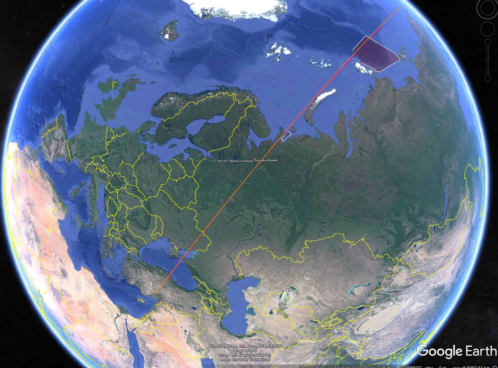
Image: JCM; background map: Google and others noted in map
On Nov 15 at about 0245 UTC Russia launched a Nudol' suborbital antisatellite missile from Plesetsk. The missile intercepted the defunct Soviet satellite Ikar No. 39L (codename Kosmos-1408) a few minutes later, possibly at 0250 UTC over about 60E 75N. Kosmos-1408 was in a 465 x 490 km x 82.6 deg orbit at the time. The intercept occurred at a height of 468 km above the Earth ellipsoid (486 km above the fictive 6378 km spherical Earth used for orbit parameters). The International Space Station passes through resulting debris cloud every 93 minutes, and the crew were instructed to take safety preparations including closing hatches and being ready for evacuation if needed. As of this writing, however, there is no evidence of any debris hits from the cloud on ISS.
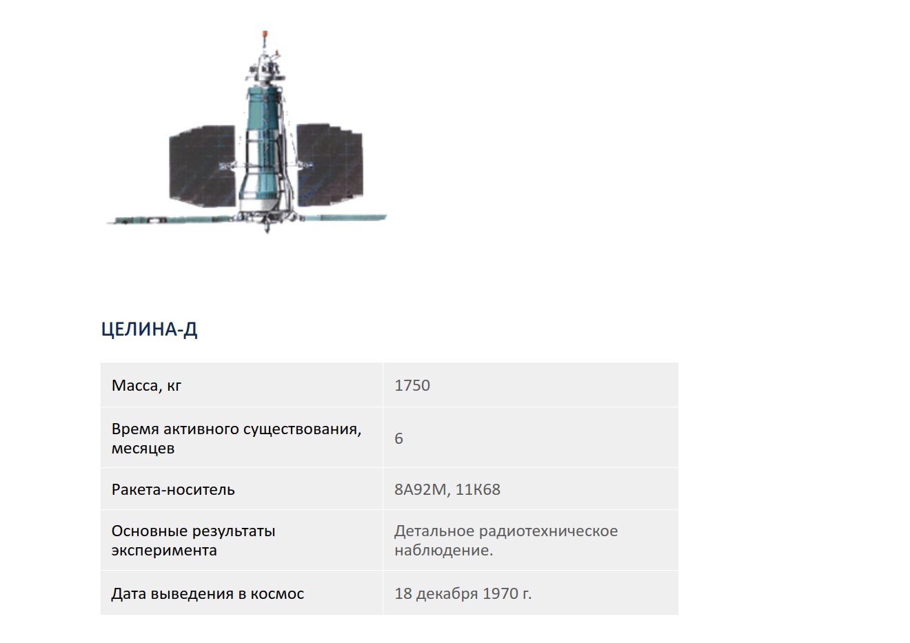
Image credit: Yuzhnoe
This data on Tselina-D comes from the Yuzhnoe web site.
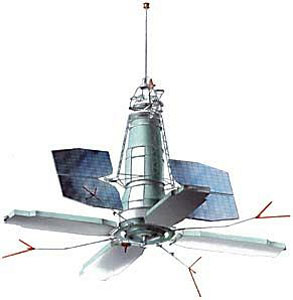
Image credit: Yuzhnoe
This image of the similar Tselina-R satellite gives a clearer view of the elint antenna `paddles'. However, the four forked boom antennae may be unique to the Tselina-R model.
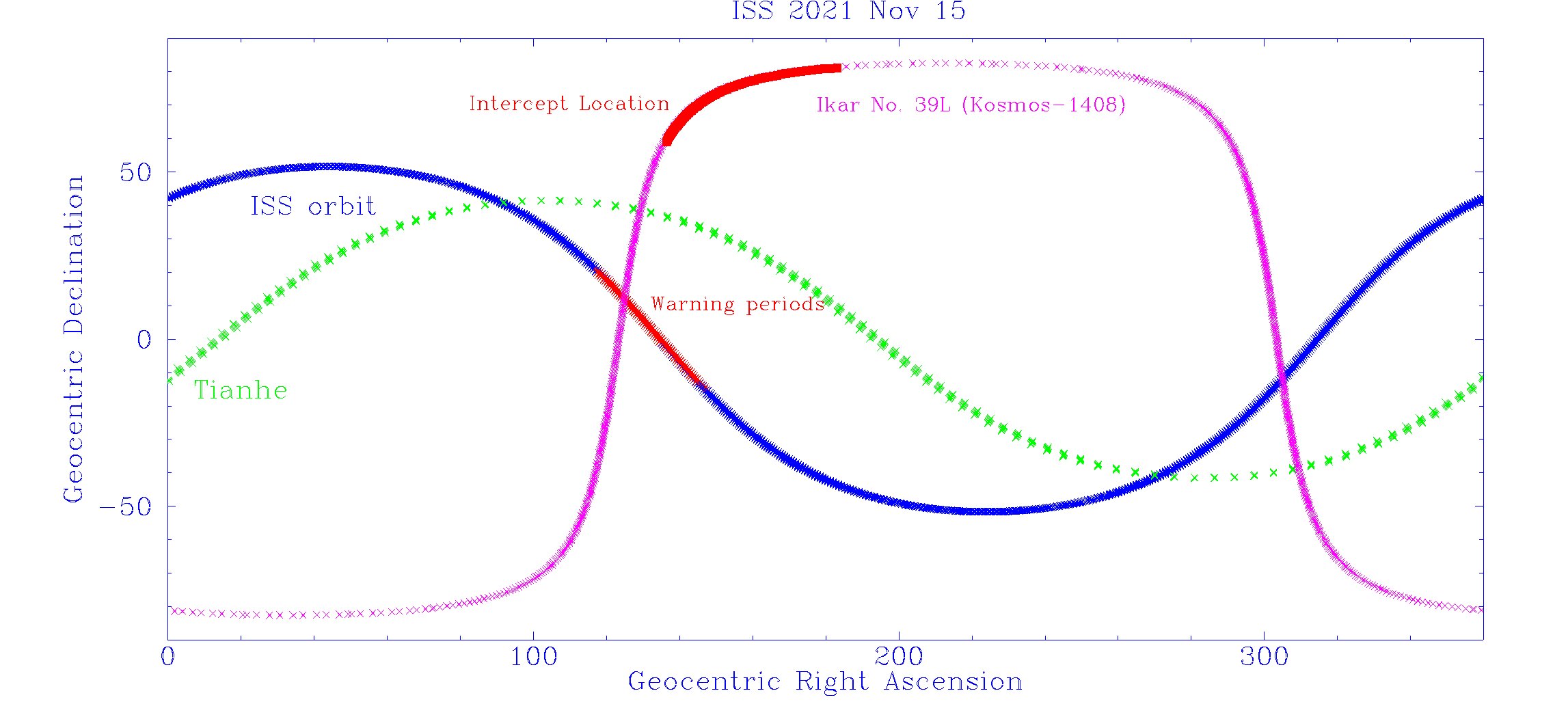
Image: JCM
Geometry of the Nov 15 test, in inertial coordinates. In this frame, the orbital path of a satellite is essentially constant on timescales of a day or so (unlike a plot in geographic coordinates where the Earth's rotation means that each orbital pass is in a different location). The orbit of Kosmos-1408 is in magenta with the approximate location of the intercept marked in red. The orbit of the ISS is in blue. During Nov 15 the astronauts were given debris cloud passage warnings every 93 minutes, corresponding to a fixed orbital position in this coordinate system indicated in red. This orbital position coincides with the passage of the ISS through the Kosmos-1408 orbital plane.

Image: JCM
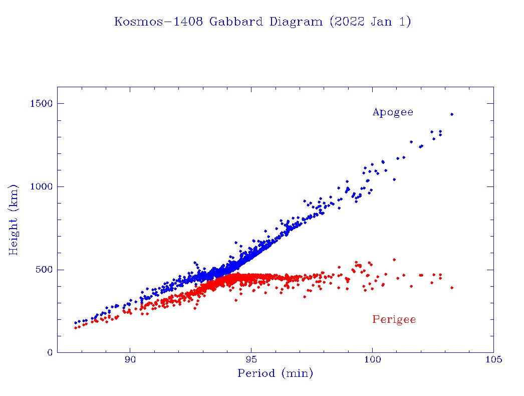
Kosmos-1408 (a Yuzhnoe built Tselina-D model signals intelligence satellite whose military designation was Ikar No. 39L) was launched in 1982 and probably operated for about two years. It had a mass of 1750 kg. The satellite did not have a propulsion system and the plot shows its steady orbital decay over time, modulated by solar activity. The ISS orbital height is shown in red for comparison.
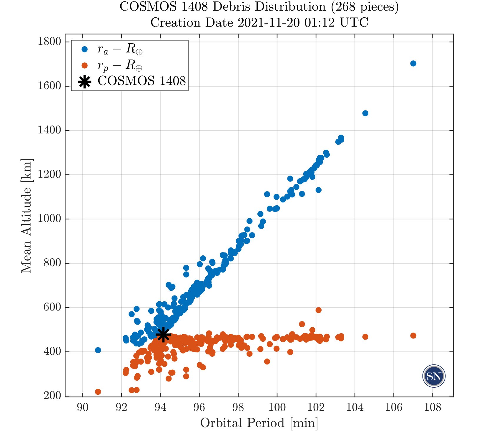
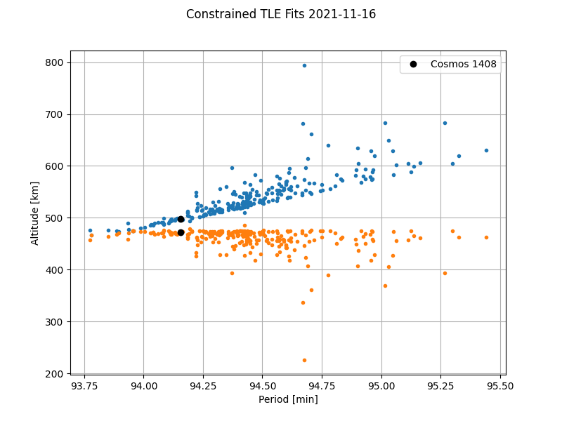
Image credit: SpaceNav (left); LeoLabs (right)
The company SpaceNav has early access to Space Force tracking data and provided the Gabbard diagram at left for the debris on Nov 20. LeoLabs has its own tracking and it published the Gabbard diagram at right for data up to Nov 16.
By the end of the year 904 objects had been cataloged by Space Force: (Image: JCM)